Grays Arch Loop
Red River Gorge Geological Area, Kentucky
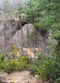
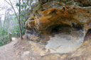
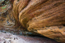
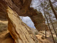
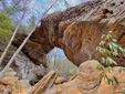
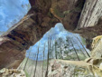
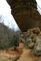
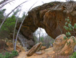
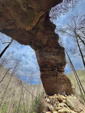
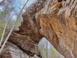
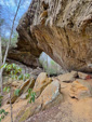
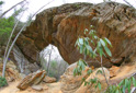
Grays Arch, one of the largest arches in the Red River Gorge at 50-feet high and 80-feet long, beckons numerous hikers to come stand beneath its massive clifftop span and scramble around the arch’s substantial buttress – reaching this famous and popular formation can be accomplished by hiking a 4-mile loop or via a shorter 2.2-mile out and back option.
The longer loop trail option, subsequently described here, gives you a chance to not only view the arch, but to also experience the solitude and impressive geology and topography of the Cumberland District in the heart of the Red River Gorge.
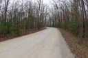
To begin your Red River adventure, make your way to the trailhead at the Grays Arch Picnic Area – the picnic area is located along the gravel Tunnel Ridge Road (Forest Service Road 39) approximately 1-mile off KY 15.
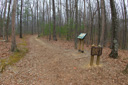
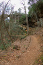
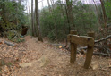
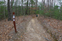
Grays Arch Trail #205 begins at the Grays Arch Picnic Area, where you will find tables and two vault toilets – follow the path for 0.23-mile then turn right onto the Rough Trail #221. Hike an additional 0.2-mile and the trail begins its descent into the ravine.
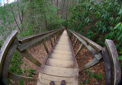
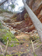
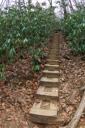
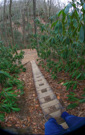
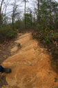
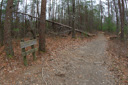
After hiking just under a mile, you will reach a set of steps – climb down the steep staircase to a trail junction. A left takes you further into the gorge along the Rough Trail, a right leads you up the rock amphitheater to Grays Arch.
Standing under the enormity of the impressive arch is thrilling – take your time admiring the beauty of this formation, the perfect place for a snack, before continuing your adventure.
From the arch, you can retrace your steps for a 2.2-mile jaunt or you can choose the longer loop option – simply head back to the junction. A left will take you back the way you came and a right leads you into the scenic forest.
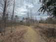
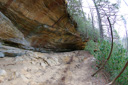
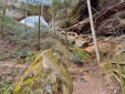
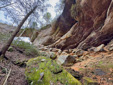
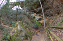
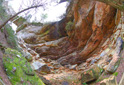
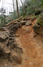
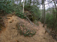
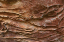
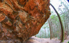
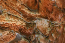
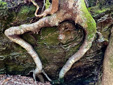
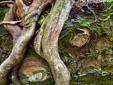
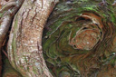
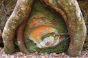
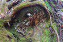
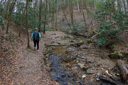
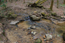
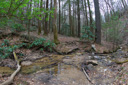
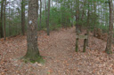
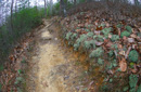
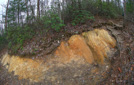
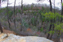
Taking a right at the junction, to continue on the Rough Trail, we hiked past huge boulders with erosion patterns reminiscent of a fairy tale – after about a quarter mile the trail reaches King Branch where you can feel the coolness of the deep forest.
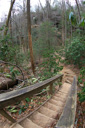
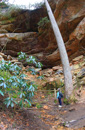
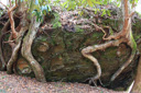
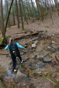
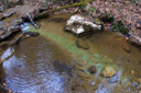
King Branch, a lovely stream that meanders through the forested flat, must be crossed three times before you begin climbing out of the ravine – another series of steps takes you out of the hollow to the ridge.
Another junction marks the intersection of the Rough Trail and the Rush Ridge Trail #227 – at this point, 2.6-miles into your journey, follow the Rush Ridge Trail along a level path for another mile along the ridge.
Views of Pinch-Em-Tight Ridge open up as you make your way to the end of the loop – at mile 3.6 you will begin hiking on the Pinch-Em-Tight Trail 223, which is also part of the Sheltowee Trace, until you reach the gravel of Tunnel Ridge Road. Walk along the road to the parking area to end your hike where you started.
 |
 |
 |
 |
 |
 |
 |
 |
 |
 |
 |
 |
 |
 |
 |
 |
 |
 |
 |
 |
 |
 |
 |
 |
 |
 |
 |
 |
 |
 |
 |
 |
 |
 |
 |
 |
 |
 |
 |
 |
 |
 |
 |
 |
 |
 |
 |
 |
 |
 |
 |
 |