Rock Bridge Loop Trail #207
Clifty Wilderness, Red River Gorge, Kentucky
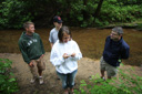
The 1.35-mile Rock Bridge Loop Trail offers excellent opportunities to explore and enjoy all that the Red River Gorge Geological Area has to offer—found along this trail are open hardwood forests, wildflowers, a scenic gorge, a waterfall, and of course, a natural bridge.
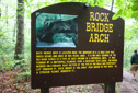
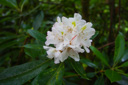
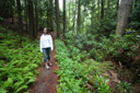
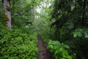
To reach the trailhead, follow Rock Bridge Road three miles to the picnic area and parking lot—begin your hike at the interpretive sign located across from the parking area. The trail quickly begins its descent into a lush ravine of ferns, broadleaf magnolia, tulip poplar, laurel and rhododendrons, which were blooming when we hiked the trail in late June—a nice contrast to the unappealing paved surface of the trail. Thankfully, the pavement soon ends and the trail becomes a dirt path—a much more natural way to explore the area, complete with stone steps and wooden footbridges. As you make your way into the gorge, you will cross a stream at mile 0.13 via a footbridge—near this point, you will see a huge cave-like opening in the cliff off to the right—this is Rock house. Climb the short spur trail to the opening for a closer look at the unique formation and then return to the main trail and continue your descent—at mile 0.34 the trail bottoms out at Rockbridge Fork, now visible along the right side of the trail.
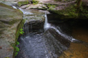
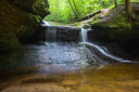
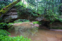
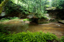
Leaving the picturesque stream, the trail climbs through a shady forest of magnolia and hemlock before rejoining the creek at a small waterfall—12 foot high Creation Falls. On our visit, the water level was low but Creation Falls was still beautiful, in fact, we could see behind the veil of water for a glimpse of an arch in the making—if we return in about 25,000 years, it should be complete. At this point, you can cross the creek and descend to the base of the falls on the opposite bank, or continue following the main trail and cross at the bottom of the falls—if you choose to cross the creek, be careful, the rocks are slippery and you might find yourself on your backside like Reader—ouch! Once you leave Creation Falls, the stream meets Swift Camp Creek and then Rock Bridge is just around the corner at mile 0.66—note that water is actually flowing under the span, making it a “true” natural bridge.
Rock Bridge arch formed when a waterfall eroded the soft interior rock but not the hard limestone layer on top—the exact process taking place at Creation Falls. It is possible to scramble up and over the arch if you so choose, but it was raining during our hike and we felt the wet surfaces deemed a climb unsafe—looked like fun though. After enjoying Rock Bridge, continue along the trail via a notch cut in the base of the bridge—follow the paved path (yep, the asphalt doth return) as the trail climbs steeply to a trail junction. Stay to the left and continue climbing towards an overlook— the worst of the climb is now over and the parking lot is within reach. The trail ends at the picnic area, east of the parking lot.
 |
 |
 |
 |
 |
 |
 |
 |
 |
 |