Table Rock
Monongahela National Forest, West Virginia
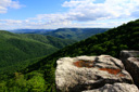
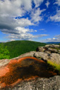
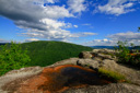
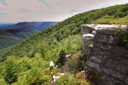
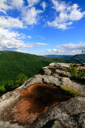
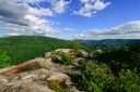
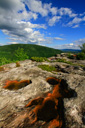
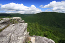
Table Rock, a high elevation plateau hidden within the Canaan Mountain Backcountry Area, provides the hiker with an amazing view for the effort—to see the view for yourself, simply follow the gentle grade of Forest Trail No. 113 for a moderate 1.2-mile hike to the Table Rock outcrop, which features incredible panoramas of the Dry Fork and Cheat River Valleys.
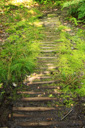
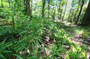
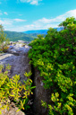
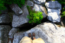
The hike begins along the Canaan Loop Road, approximately ten miles west of State Road 32, where you enter a northern hardwood forest of beech, black cherry, maple, and yellow birch—the rocky, yet comfortable walking trail showcases the trees, mosses, and ferns of the Potomac Highlands.
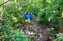
The trail is nearly level for the entire 1.2-miles—at 0.6-mile the trail descends slightly, leveling out in a rhododendron thicket that can be muddy in spots. In many areas, wooden planks have been added to help keep your feet dry as you make your way through the muck.
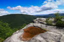
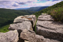
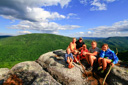
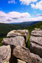
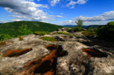
Table Rock Trail, also known as Forest Trail No. 113, eventually opens up onto the high plateau of Table Rock itself—a massive rock outcrop divided by crevasses that are several hundred feet deep. From the level summit, you bask in your reward—expansive views of Green Mountain, Dry Fork Gorge, and the Cheat River Valley.
 |
 |
 |
 |
 |
 |
 |
 |
 |
 |
 |
 |
 |
 |
 |
 |
 |
 |
 |
 |