Upper Hawksbill Trail
Shenandoah National Park, Virginia
Hawksbill Summit, the highest mountain in Shenandoah National Park, consistently ranks as one of the most popular hikes in the park – owing mainly to the easy access to excellent summit views and bragging rights to tagging the park’s high point.
Three trails lead to the summit (see NBH Tip), but the one described here gains the least amount of elevation making it the least steep route to the top – known as the Upper Hawksbill Trail, it allows the hiker to reach the high point by climbing just 489 feet in a smidge over a mile.
To reach the trailhead, head for the Upper Hawksbill parking area at mile marker 46.7 along Skyline Drive – due to its popularity, you may have to jockey for one of parking spots.
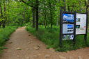
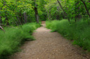
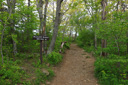
After you score parking, gather up your water, snacks and backpack and head for the kiosk near the forest entrance - after a short steep stretch you will have a steady, relatively easy climb through a young hardwood forest.
Once you have covered about 0.7 mile in distance, the trail will dead-end – here the path intersects with a fire road (the Hawksbill Trail/Byrds Nest #2 Road). Turn right to continue to the summit – a left takes you along the fire road about half a mile back to the Skyline Drive at mile 47.1.
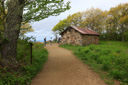
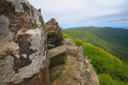
In just another 0.25 of a mile, the blue-blazed Salamander Trail comes in on the left – if you follow it you will reach the Appalachian Trail in about 0.8 mile. To the right, Lower Hawksbill Trail leads to Hawksbill Gap, at mile 45.6 along the Skyline Drive. High pointers must continue on the fire road where you eventually reach Byrds Nest Shelter #2, good views can be had from here but keep hiking just a bit farther to the observation platform on the summit.
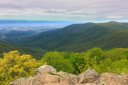
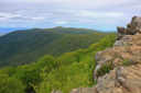
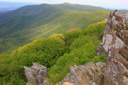
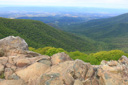
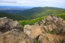
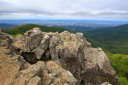
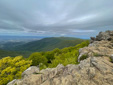
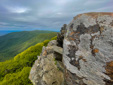
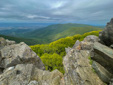
You are now standing on Hawksbill summit, at elevation 4,050 feet, it is the highest point in Shenandoah National Park.
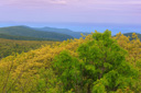
Wide sweeping views to the west and south of the mountain are your reward – look for peaks and Shenandoah Valley landmarks such as the town of Stanley, the rounded crest of Nakedtop, Betty’s Rock, Buracker Hollow, Millers Head, Bushytop, Stony Man, Little Stony Man, Crescent Rock, and in the distance is the rocky summit of Old Rag.
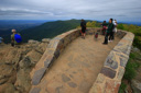
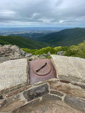
Enjoy the summit views, taking time to orient yourself to the surroundings via the topographic plaques located around the stony wall of the summit observation platform – to return to your car you will simply retrace your steps 1.05 miles to the parking area, for a roundtrip hike of 2.1 miles.
 |
 |
 |
 |
 |
 |
 |
 |
 |
 |
 |
 |
 |
 |
 |
 |
 |
 |
 |
 |