Gorge-Rim Trail Loop
Buttermilk Falls State Park, New York
Buttermilk Falls State Park, just a short distance southwest of Ithaca’s Cayuga Lake, protects towering waterfalls and multi-tiered cascades, the wooded glen of an ice-age gorge, the clear water of Lake Treman, and the mixed woods and wildflowers of Larch Meadows—truly a highlight of New York’s Finger Lakes Region.
A hike, of course, is the best way to enjoy the unique geology and flora and fauna of Buttermilk Falls State Park—follow the Gorge-Rim Loop for prized views of Buttermilk Creek as it plunges more than 500 feet through a gorge on the eastern slopes of Cayuga Lake.
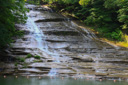
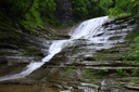
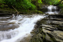
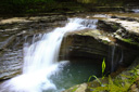
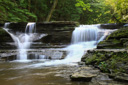
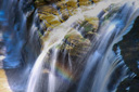
Buttermilk Falls, the wispy culmination of Buttermilk Creek’s 500 foot free fall, greets hiker’s making their way across the dam to the foot of the Gorge Trail along the south wall—the colossal waterfall, plunging lazily over a 165-foot canted cliff, might be the park’s namesake, but better views await the further you ascend into the gorge.
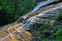
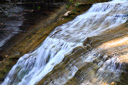
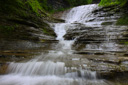
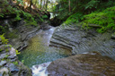
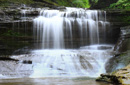
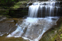
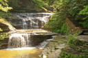
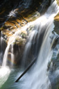
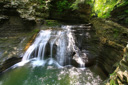
Climbing the Gorge Trail along the edges of Buttermilk Falls affords views of the lower tier and swimming hole (also visible from the parking lot in the lower area) and eventually the upper tier of Buttermilk Falls as well—keep climbing through the cool, moist gorge past deep pools, rock formations, including Pinnacle Rock, that have been sculpted by water over eons of time, and at least 9 other waterfalls varying from 5 to 35 feet in height.
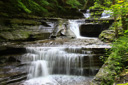
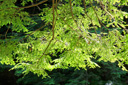
The lower section of the gorge is very similar in beauty to the deeply saturated gorges of Watkins Glen State Park and Robert H. Treman State Park—two must see parks in the Finger Lakes Region. If you are lucky enough to be visiting on an overcast summer day, the greens of the understory and leafy canopy will be so saturated with color that you will swear they are neon—cloudy skies are also the perfect time to show off your photography skills with a few slow-shutter shots of the waterfalls.
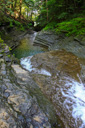
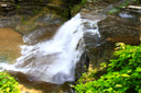
The cascades of Buttermilk Creek are typical of the area—sandwiched layers of shale and limestone have been eroded into a variety of shapes and sizes, creating an infinite assortment of waterfalls spilling over the many precipices. Hoops and I, the shutterbugs of the group, literally found ourselves setting up our tripods around every corner—each cascade, plunge pool, and rock pillar had a unique look that begged to be photographed.
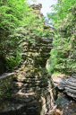
After hiking nearly 0.6-mile, you reach Pinnacle Rock—a 40-foot chiseled spire isolated from the cliff, standing on the creek-side of the trail.
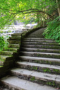
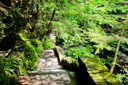
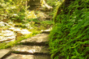
Continue climbing along the Gorge Trail, past Pinnacle Rock, until you reach the pavement of West King Road—leave the shade of the hemlock and fern forest, crossing Buttermilk Creek via the road to access the Rim Trail.
Once you have crossed over the creek, look for the Rim Trail along the left side of the road—the wide dirt lane descends back into the gorge along the north side of Buttermilk Creek, views are few and far-between as you make your way back to the lower parking area.
 |
 |
 |
 |
 |
 |
 |
 |
 |
 |
 |
 |
 |
 |
 |
 |
 |
 |
 |
 |
 |
 |
 |
 |